 
Fareastsider
Member
Username: Fareastsider
Post Number: 19
Registered: 08-2006
| | Posted on Sunday, December 10, 2006 - 9:55 pm: |    |
Does anybody know how much open land there was when Detroit finally expanded at its furthest in 1926? During this time was most of this outer land vacant and being farmed anybody have any idea. From what I can see it would appear most of the annexed lands were undeveloped |
Mikeg
Member
Username: Mikeg
Post Number: 396
Registered: 12-2005
| | Posted on Sunday, December 10, 2006 - 10:19 pm: | |
Here is a map showing which areas were developed as of 1930 (dark green) and which areas were losing population when compared to 1920 (olive).
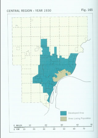
City of Detroit Population:
1920 - 994,000
1930 - 1,569,000
Wayne, Oakland and Macomb County population:
1930 - 2,177,000
[source: Emergence and Growth of an Urban Region - The Developing Urban Detroit Area (Volume 3), The Detroit Edison Co., 1970]
Keep in mind that the reason a city uses annexation is to acquire developed areas of townships and capture their tax base.
(Message edited by Mikeg on December 10, 2006) |
Lmichigan
Member
Username: Lmichigan
Post Number: 4862
Registered: 10-2003
| | Posted on Sunday, December 10, 2006 - 11:35 pm: | |
That's not the only reason a city annexes land, though it's usually the most prevalent use of annexation. |
Mikeg
Member
Username: Mikeg
Post Number: 397
Registered: 12-2005
| | Posted on Monday, December 11, 2006 - 12:04 am: | |
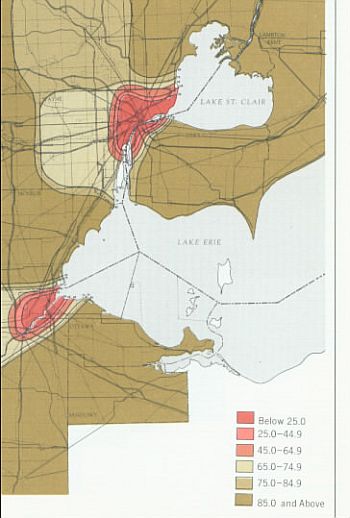
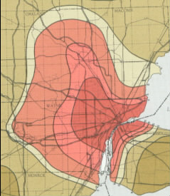
Here are maps showing the percentage of farmland in 1920 and again in 1940 (a 1930 map was not included in the source book).
1920 map:
1940 map:
This map shows the evolution of development in the tri-county region from 1837 through 1965. The key to the color coded dates is given separately so it would be legible.
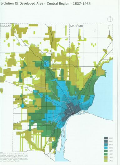
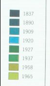
[source: Emergence and Growth of an Urban Region - The Developing Urban Detroit Area (Volume 3), The Detroit Edison Co., 1970] |
Jjaba
Member
Username: Jjaba
Post Number: 4565
Registered: 11-2003
| | Posted on Monday, December 11, 2006 - 12:43 am: | |
jjaba's father, alva sholem, always told jjaba that the Detroit City Limit was Grand Blvd. when he arrived Detroit in 1928. He told me about the widening of Woodward Ave. to The Blvd. also.
Detroit got a whole lot bigger in one man's lifetime.
Certainly jjaba remembers when north of 8 Mile Rd. was farms. Post-war suburbs like Southfield and Oak Park, the building of Northland Center in 1954, and many other projects are clearly recalled by this author.
jjaba, Westsider. |
|