 
Dan
Member
Username: Dan
Post Number: 1200
Registered: 10-2003
Posted From: 69.47.194.247
| | Posted on Thursday, April 06, 2006 - 6:55 pm: |    |
Hornwrecker,
I love the Sanborn maps you post. Could you post one of Park Ave and Elizabeth area, more specifically the blocks across from the Blenheim?
I would really appreciate it. I have long wondered about that area, and have begun piecing together what was there, but a map would sure help.
Thanks 1 million |
Hornwrecker
Member
Username: Hornwrecker
Post Number: 1014
Registered: 04-2005
Posted From: 66.2.148.86
| | Posted on Thursday, April 06, 2006 - 11:45 pm: | |
Initial look at the west side of Park, shows a rooming house, some flats and storefronts across from the Blenheim (another Ilitch holding). It seems like the current structures were built after 1921 on that side of the street.
The dividing lines of the maps are Park and Elizabeth, so each corner will be a separate cropping and PSing. Anything specific? |
Hornwrecker
Member
Username: Hornwrecker
Post Number: 1019
Registered: 04-2005
Posted From: 66.2.148.21
| | Posted on Friday, April 07, 2006 - 9:55 pm: | |
Here's the Blenheim Apts and Park Hotel in 1921. The "D"s are single family dwellings, "F"s are apts.
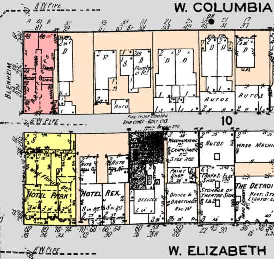
Interesting the Storage of Theatre Signs at 30 Elizabeth (old address). |
|